Environmental indices through LandSAT images
Patents for licensing
The Spanish National Research Council (Consejo Superior de Investigaciones Científicas, CSIC) has developed the software GINASAT version 1.0 (Semi-Automatic Generation of Environmental Indices by Landsat), to automate the extraction of information from Landsat satellite images downloaded from USGS (US Geological Survey) server (http://earthexplorer.usgs.gov/). The program has been developed in version 1.0 and it runs integrated into ArcGIS©, for different versions from 10.

An innovative technology to classify data from satellite, integrated into ArcGIS
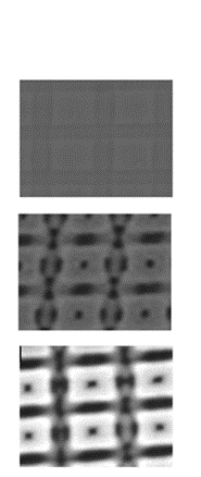
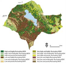
Vegetation persistence and vigor in the municipalities of the Natural Reserve of Gallocanta Lake GINASAT v1.0 includes four subprograms: 1) Download: it allows Landsat images downloading from EarthExplorer (http://earthexplorer.usgs.gov/), georeferenced in WGS84; 2) Composite: multiband image generation; 3) Correction: radiometric correction of Landsat Thematic Mapper (4 and 5) and Landsat 7ETM+); 4) Indexes: calculation of two indexes for environmental applications, normalized difference vegetation index (NDVI), and Tasseled Cap transformation, developed to reduce multispectral data down to three main components, namely brightness, greenness and moisture.The program takes the metadata from the original header files.
GINASAT v1.0 facilitates processing of time series of satellite images in order to obtain spatial information in a systematic way so as to manage areas of interest. It allows monitoring of physical variables related to land cover and vegetation significantly reducing time spent processing data.
Main innovations and advantages
Developing chain function for raster objects within · ArcGIS provides three key elements:
· Increase the versatility of ArcGIS with the raster domain.
· Saves time by automating the processing and at the same time maintaining the consistency and compatibility of data within · ArcGIS.
· Upgradeable and accesible as it is written in Python language.
No similar tool is known in image processing programs, comercial or free, and even less in · GIS programs.
The Spanish National Research Council (in Spanish 'Consejo Superior de Investigaciones Científicas (CSIC)') is a government agency for basic and applied scientific research.
It is the largest public research organization in Spain, with presence in all the Autonomous Communities through 126 centers and 145 associated units.
Create your free account to connect with CSIC - Consejo Superior de Investigaciones Científicas and thousands of other innovative organizations and professionals worldwide
Send a request for information
to CSIC - Consejo Superior de Investigaciones Científicas
Technology Offers on Innoget are directly posted
and managed by its members as well as evaluation of requests for information. Innoget is the trusted open innovation and science network aimed at directly connect industry needs with professionals online.
Need help requesting additional information or have questions regarding this Technology Offer?
Contact Innoget support