Smartroad Tools - non-destructive sub-road/sub-rail inspection
Patents for licensing
Railways and highways form a major part of any nation's infrastructure. Their construction and maintenance are high priorities for any country. Together, they represent a 160 trillion dollar worldwide investment. Rail and road are essential to the economy, providing safe and convenient transportation for people and for industrial and agricultural goods.
Heurika Geographics has developed an innovative technology to non-destructively monitor the integrity of this infrastructure. It is very lost cost compared to alternatives, so it can be used widely without much impact on construction costs.
We have a new technology for the highway, airport, railway, and surface water control industries. The technology permits non-destructive inspection of the ground supporting this critical infrastructure, thus reducing chances of life-threatening failures and providing major savings on maintenance costs.
The Problem
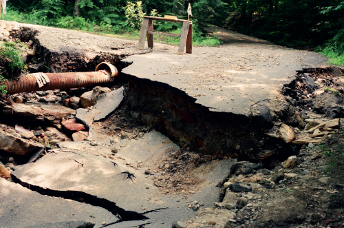
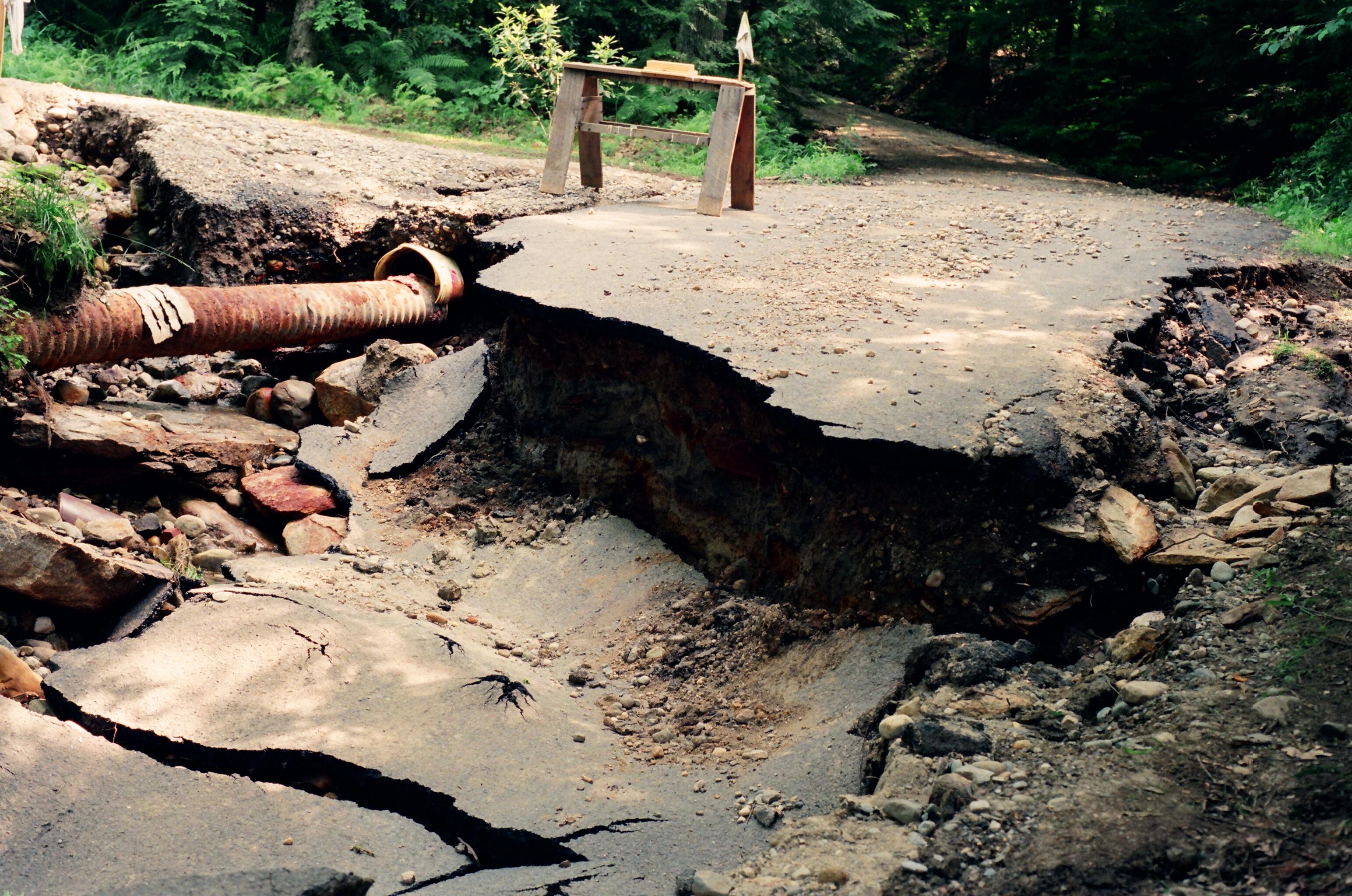
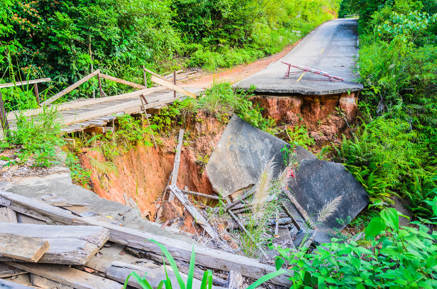
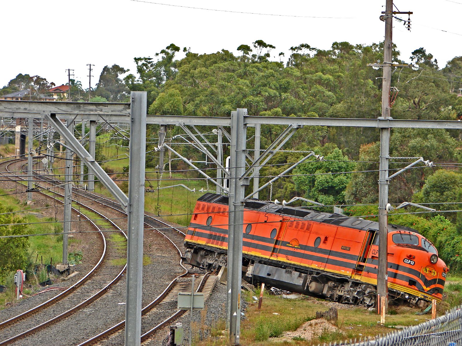
All over the world, highways, railways and airports are collapsing. This is alarming, since transportation forms a major part of any nation's infrastructure. It is used every day by almost everyone, and is the backbone for distribution of all agricultural and industrial products.
All transportation constructions share a common weakness: they depend for their support on the underlying ground. Once construction is completed, the behavior of the supporting earth is unpredictable. Cavities and fractures can develop due to floods, erosion, drought, leaks from landfills and hazardous waste dumps, nearby construction, micro-earthquakes and other geological and hydrological forces.
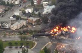
Weaknesses in the underlying earth cannot be seen or even easily detected on the surface. Ultimately a failure will occur, perhaps as a road collapse, perhaps as a rail track misalignment sufficient to wreck atrain. The minimum implication of such a failure is a need for an expensive emergency repair, quite possibly during inclement weather since storms commonly trigger collapses due to pre-existing weaknesses. The collapse may cause the facility to be closed for an extended time, forcing travel and shipping to be rerouted for days or even months. In extreme cases towns can become isolated. Failures while transporting hazardous materials cause extensive property damage and loss of life.
Preventing or warning of such events has a high human and economic value.
There is a clear need for a way to quickly and easily determine the integrity of the foundation which supports road, rail, and other infrastructure. This need is not met by currently available technology.
Our New Technology
We have developed a technology which can solve this problem. Our technology is based on a “smart” geofabric – a standard geofabric such as currently used in road and rail construction, with electronics added. This geofabric is embedded into the underlying earth during construction or reconstruction. Once installed, the geofabric is entirely passive. It does not require any power or external electrical connections, either permanently or during use. The fabric is designed so that degradation in the earthen base will damage the electronic components. An active sensor array traveling above the surface will query the integrity of the geofabric. In areas without problems, the sensor will receive a normal response from the fabric. In locations where there is subsidence or cavitation, the damaged fabric will not respond.
Research results, which have been presented at conferences worldwide, support the practicality of this technology. We havecreated working prototypes, bringing us to Technology Readiness Level 4 § We are currently negotiating with organizations and government agencies in the United States and other countries to secure research locations where we can conduct full-scale field validation. Currently we appear to have two sites available in Thailand and possibly one in the U.S. Thus, we expect to be able to bring our technology up to Technology Readiness Level 6 in 2018, and to Technology Readiness Level 7 in 2019.
We expect that Smartroad Tools will dramatically change the way transportation infrastructure is protected and maintained. The Transportation Research Board of the (U.S.) National Academy of Science, in their Research Needs Statement Automated Sensing for Construction Quality Monitoring of Concrete Pavements, and Smart Long-Term Tagging System, 2013, said such a capability “ ... could transform the economics of highway construction inspection and ultimately improve the safety and quality of road systems ... both industry and government will benefit from such systems by reducing reliance on slow and
sometimes poorly managed testing programs.”.
--------------
§ Technology Readiness Levels are a means that many government agencies in the U.S. and Europe use to characterize the maturity of a new technology. We are using the definitions from the U.S. General Accounting Office (GAO). Wikipedia.org has a convenient summary article.
Desired business relationship
Technology selling
Patent licensing
Joint ventures
Technology development
New technology applications
Adaptation of technology to other markets
Other : Inspection As A Service
Current development status
Laboratory prototypes
Applications
Highway, Railway, Airport runway, Flood control dikes, Mine tailings dikes
Heurika Geographics was incorporated in May 2015 in Singapore by Kurt Rudahl and Sally Goldin, the inventors of the new Smartroad Tools (tm) technology. The purpose of Heurika Geographics is to capitalize on the technology. This will be done though a combination of forming manufacturing and/or sales subsidiaries in various geographic regions, establishing joint ventures with companies in related industries, and licensing to already-established manufacturers.
Create your free account to connect with Kurt Rudahl and thousands of other innovative organizations and professionals worldwide
Send a request for information
to Kurt
Technology Offers on Innoget are directly posted
and managed by its members as well as evaluation of requests for information. Innoget is the trusted open innovation and science network aimed at directly connect industry needs with professionals online.
Need help requesting additional information or have questions regarding this Technology Offer?
Contact Innoget support
